
In the 1850s, the Avenues became Salt Lake City’s first platted neighborhood. With relatively small blocks and narrow streets, its urban design encouraged the neighborliness and community that was hindered in the rest of the city by the spatial separation of 10-acre agricultural blocks and 132-foot street widths in the original Plan of Zion.
What might the future bring for this prized city neighborhood on a hill? City Hall is currently working on the public policy to guide it.
Planners are about half-way through the public engagement process for a new Avenues master plan, and briefed the planning commission this week on their progress.
The salient issues that have arisen from public feedback so far are walkability and its elements: increased housing density, access to neighborhood businesses, and transportation safety, according to planners.
But will Avenues residents accept the changes that are likely necessary for increased walkability? A 15-minute neighborhood requires businesses nearby and customers for those businesses.
That support would be historic, as the most recent changes in Avenues planning history have involved systematic downzoning – restricting the size and location of multi-family buildings, deleting commercial zoning, and discouraging mixed-use. Preservation of the status quo has ruled since.
Yet to be determined in the current planning process is the document’s final position on what the changes need to be to provide more housing and improve walkability. Will it recommend more commercial or mixed-use zoning? Better pedestrian, bike, and transit infrastructure?
Let’s take a look at the process so far and what’s still to come.
Historical backdrop and the most recent (1987) plan
In 1987, when the Avenues’ master plan was last updated, the future land use map called for preservation of the status quo: no development above 18th Avenue and no changes to existing zoning.
The 1987 plan – still in effect until the city council officially adopts a new one – also heralds the “creation of the Historic Landmark Committee and adoption of the South Temple and Avenues Historic Districts” as “the most significant accomplishments relating to urban design in the Avenues Community.”
Those accomplishments in the 1970s provided the on-ramp for the city’s downzoning era in the 1980s and 90s. The great zoning rewrite of 1995, notorious in local planning history, downzoned neighborhood businesses to residential-only uses and shrunk multifamily zoning in the city’s “established neighborhoods” – including the Avenues.
As planners note in their Existing Conditions, the downzoning process in the Avenues had made significant progress even by 1980.
Summarizing the downzoning era, planners currenty report that “Significant zoning shifts have occurred south of 7th Avenue, where broad downzoning reduced areas once open to all housing types to those permitting only single-family homes or duplexes. Many of the areas that allowed for commercial uses have also been rezoned to residential-only districts, leaving the neighborhood with very few commercially zoned properties.”
Many of the businesses that remain, as well as missing-middle housing, are non-conforming uses, which “restrict redevelopment, limit opportunities to add housing units and prevent the establishment of new commercial uses,” states the planners’ draft.
“Walkability” was not part of the discourse at the time, as it certainly is now.
The 1987 plan is a very concise 12 pages. The first section of the new plan, the Existing Conditions Report that was just briefed to the commission, reaches 67 pages.
Existing conditions – land use, transportation, parks and open space
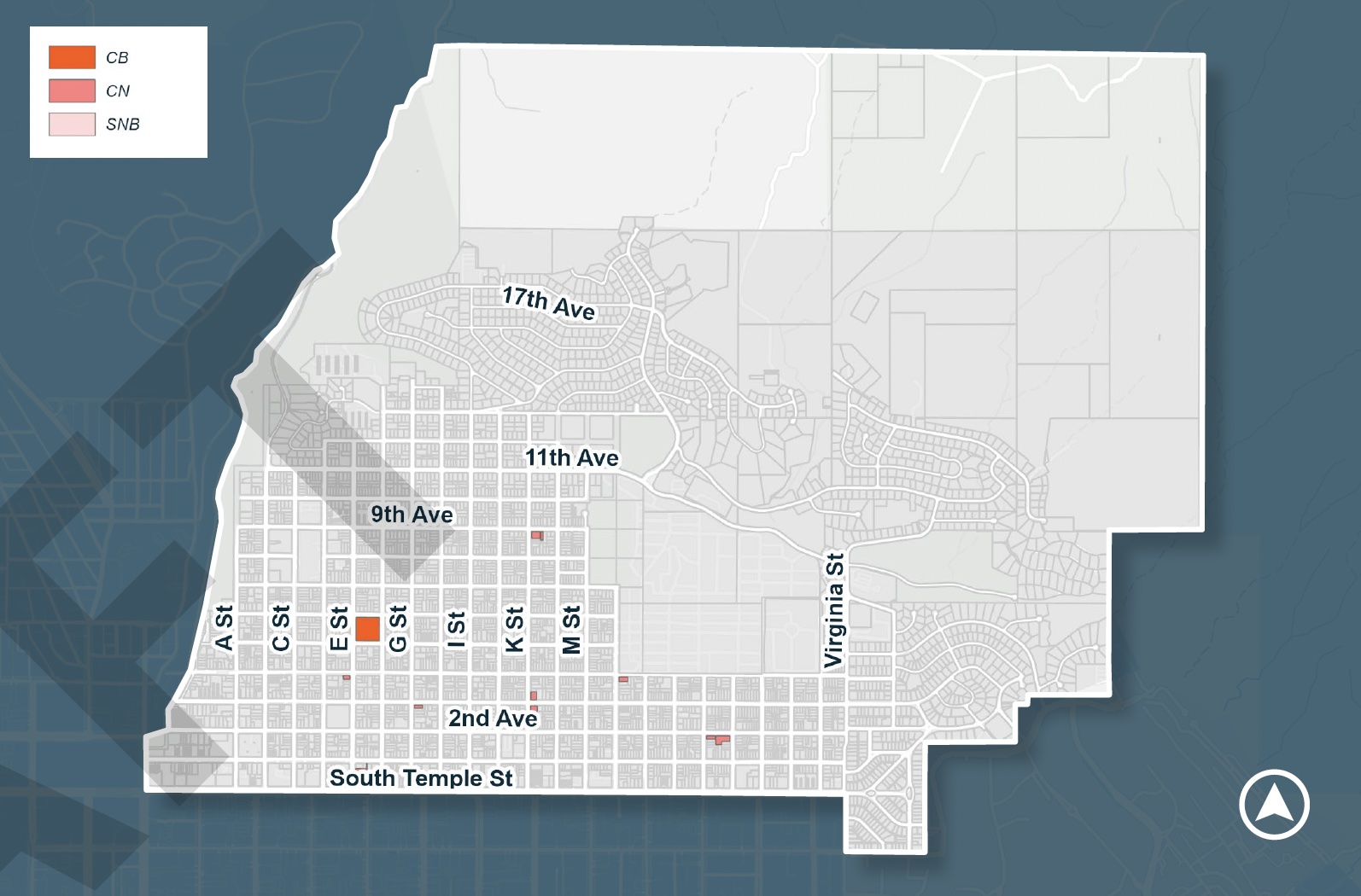
Current land use is, well, completely dominated by residential-only zoning, accounting for 97% of the neighborhood’s developable area. Mixed use, institutional and commercial zoning each account for just approximately 1% of the zoned land in the plan area.
Planning staff also showed the commission that the most common housing type in the Avenues is single family (42%), followed closely by apartments at 39% of units. Condos and townhomes make up 14% while duplexes and single-family with ADUs provide 5% of the neighborhood’s dwellings.
Almost all apartments, the report points out, are located in the Lower Avenues. That’s also where most of the diversity in housing types is found.
Another walkability component, good transit service, is not exactly present in the Avenues. Routes on South Temple and 9th Avenue are part of the city’s Frequent Transit Network and offer 15 minute service. Other UTA routes, not so much. The 11th Ave Flex bus that climbs Virginia Ave and the 2300 East/Holladay route that stops along 2nd and 3rd Avenues run only every 60 minutes.
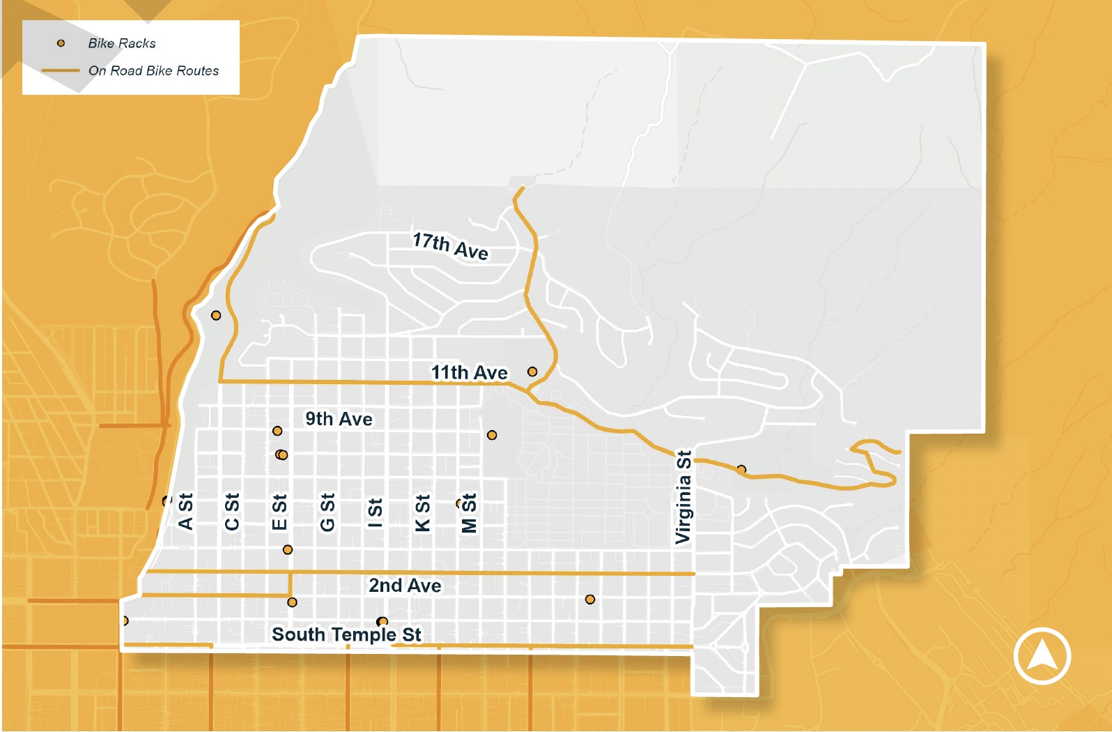
As for bicycle infrastructure, most of the streets in the Avenues are classified as local streets, which are meant to be “low capacity” for cars and are subject to a 20 mph speed limit. Dedicated bike lanes are few, and the report notes that there are no protected bike lanes within the area’s boundaries.
What about walkability to a park or open space? The Avenues might be the only neighborhood in the city that meets the policymakers’ goal to have a park or open space within a 15-minute walk of every resident. Planners were happy to report to the planning commission that 100% of the area’s households live within a 15-minute walk of a park (which includes the Salt Lake City Cemetery) or a trailhead.
What respondents are saying about land use and transportation
Planners have completed about half of their community outreach, and a number of the questions they’ve been asking at public events and stakeholder meetings involve people’s perceptions of the most important issues facing the neighborhood.
Planners say participants identified the greatest challenges as housing costs and availability, transportation safety and access, the lack of neighborhood-serving businesses, and amenities.
Is it a stretch to say that they all revolve around the conditions for improved walkability?
“Other areas of concern include redevelopment of the LDS hospital and lack of bike infrastructure,” Deputy Planning Director Michaela Bell told the commission.
Feedback on transportation, she said, highlighted safety concerns focused on “speeding and unsafe intersections,” while other transportation issues that respondents want to be addressed include “a lack of bike infrastructure, pedestrian safety, and public transit frequency.”
The types of neighborhood businesses respondents most often identified were cafés and restaurants, retail, recreation centers, and entertainment venues.
Where to allow new housing and businesses and at what scale?
The Existing Conditions Report mentions only the LDS Hospital site as an “area of potential future development,” pretty much avoiding the question altogether.
Respondents were asked about their preferences for future locations for commercial zoning.
Deputy Director Bell reported the answers as “pretty mixed.” The questionnaire offered four options: Spread throughout the avenues, on corner properties, clustered near other commercial development, or on specific streets.
“All of these locations [had] about the same percentage of responses,” she said. The specific streets that were preferred? E St and 3rd Ave were the most frequently cited.
And what about increasing the housing stock in the Avenues?
Most survey respondents want more housing throughout the neighborhood, Bell told the commission. “But compatibility of new development was greatly emphasized,” Bell cautioned.
.What that “compatibility” might consist of is given some shape in respondents’ answers to questions about housing strategy. Bell noted that “The most popular strategies for adding housing units include adaptive reuse of existing buildings, new mixed-use development, and infill development by allowing different housing types in certain areas.”
The preferred infill development types highlighted by respondents were duplexes, townhomes, small single-family, and “small-scale multifamily containing four to nine units.”
Will that be enough to provide the density required to meet residents’ desires for walkability?
Planners will be conducting public engagement opportunities through the Spring of 2026, and can be reached by email (avenuesplan@slc.gov) and through the plan’s website.